TensorForest
The Problem
Wildfires have become increasingly frequent and severe, devastating forest ecosystems and contributing significantly to greenhouse gas emissions. The UN Environment Programme (UNEP) predicts a global rise in extreme wildfires by 14% by 2030, 30% by 2050, and 50% by 2100. Climate change and wildfires form a dangerous feedback loop, worsening the damage and increasing the need for fire prevention.
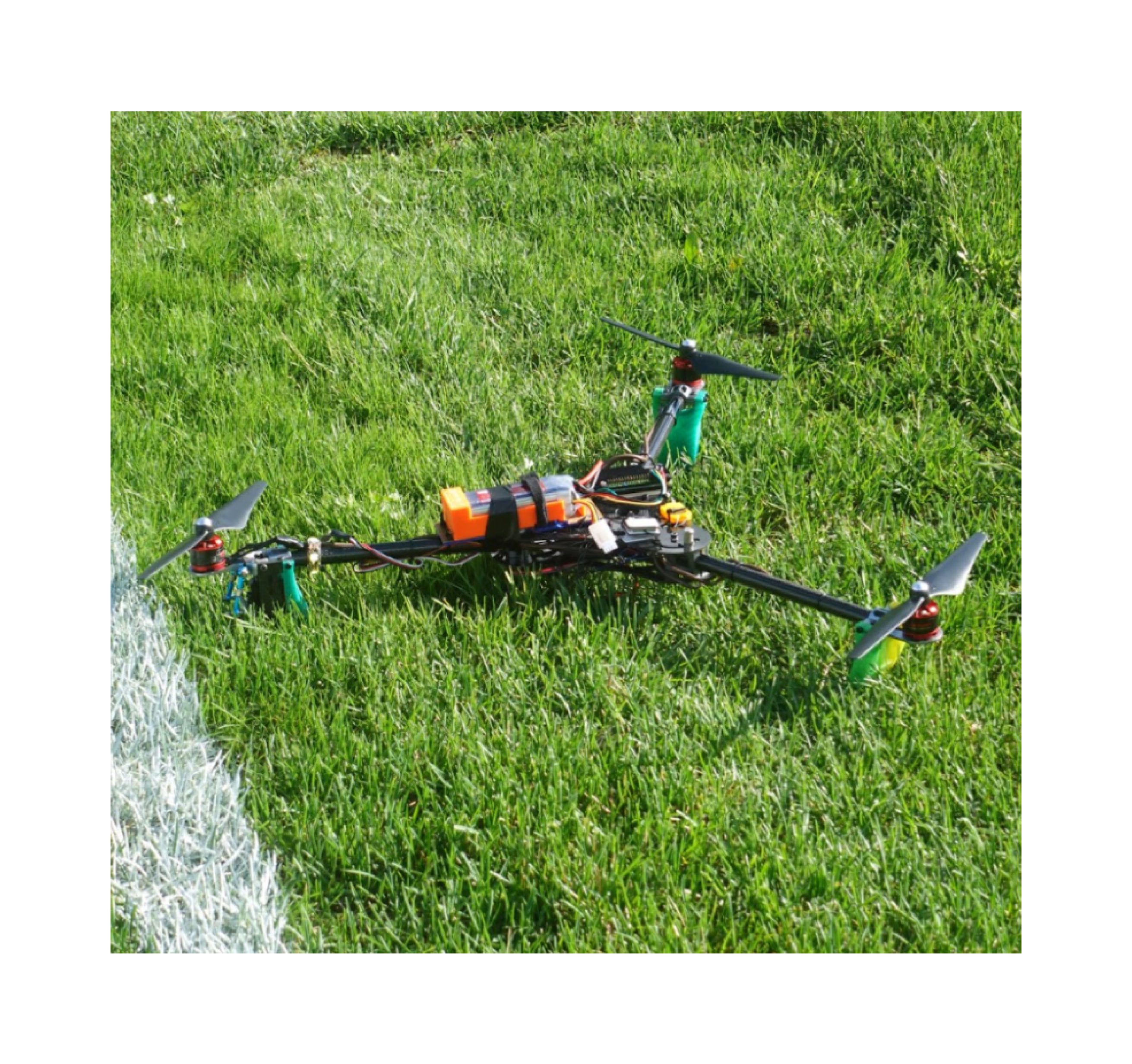
Our first prototype of TensorForest, designed to capture high-resolution forest data for wildfire risk assessment.
The Opportunity
Effective wildfire prevention requires accurate, up-to-date, real-time data. However, current solutions have major limitations:
- Expensive drones: High-end wildfire monitoring drones cost $25,000 or more, making them inaccessible to many organizations and communities.
- Manual surveying: Traditional forest monitoring methods are slow, labor-intensive, and costly.
- Limited access: Fire departments in wealthier nations have access to advanced technology, while vulnerable communities (e.g., farmers in Kenya, Indonesia, and Vietnam) lack affordable wildfire prevention tools.
- Satellite imagery limitations: Satellites do not provide high-resolution, up-to-date data necessary for proactive fire prevention.
How It Works
TensorForest is an autonomous drone system designed to provide high-resolution forest monitoring and wildfire prediction. The process includes:
- Selecting a target region for assessment.
- Generating a flight plan to autonomously cover the area.
- Capturing multiple high-resolution images and spatial data.
- Stitching images together using OpenCV to create a detailed forest map.
- Generating a Digital Elevation Model (DEM) by processing spatial points.
- Running the data through a vision transformer model, integrating climate data such as temperature and precipitation.
- Producing a wildfire risk heat map, classifying vegetation and identifying high-risk areas/fire spread patterns.
- Utilizing data for fire prevention planning, helping determine optimal locations to cut fire lines and mitigate wildfire spread.

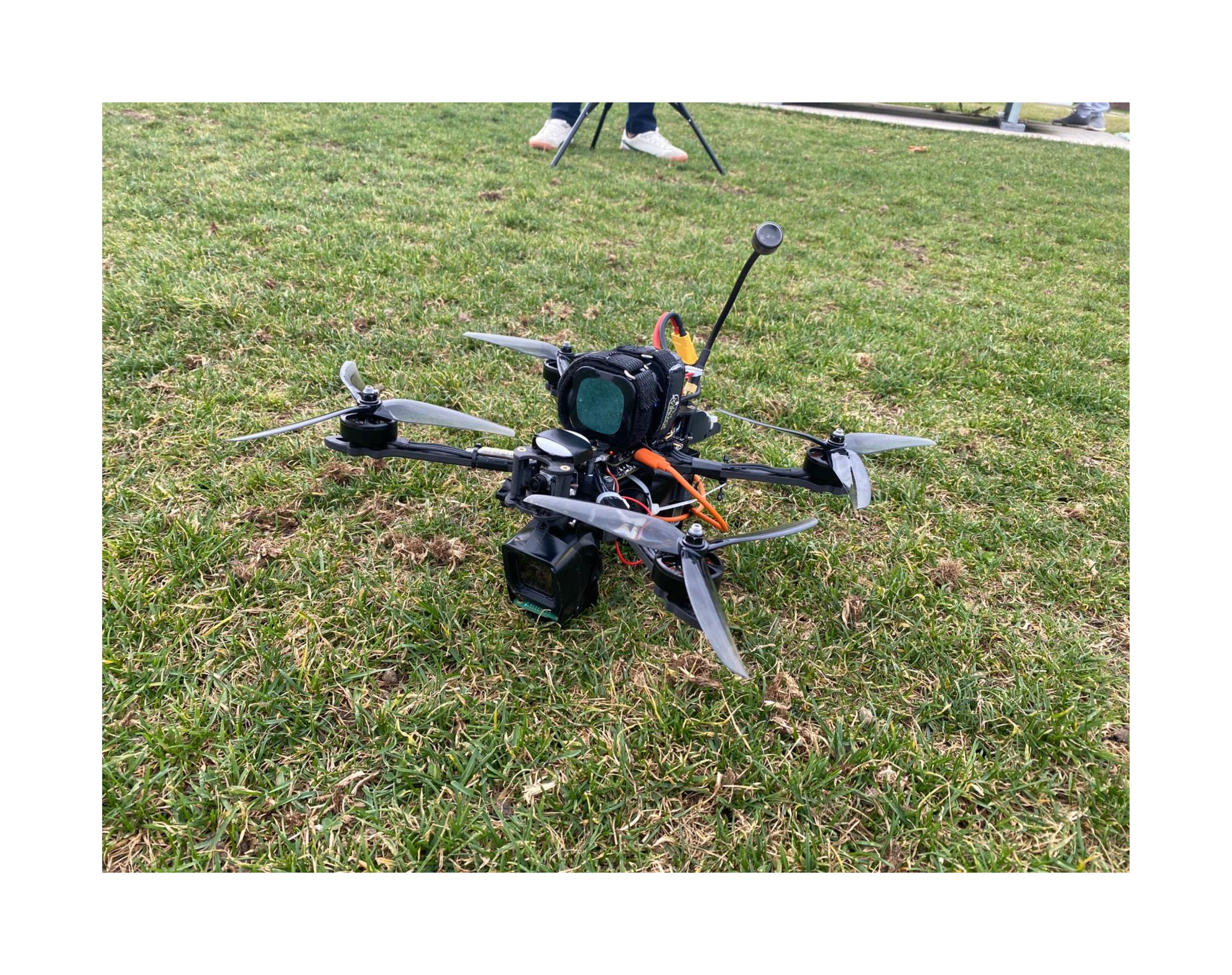
The latest version of TensorForest featuring improved hardware and AI capabilities for more accurate wildfire risk prediction.
Additional Features
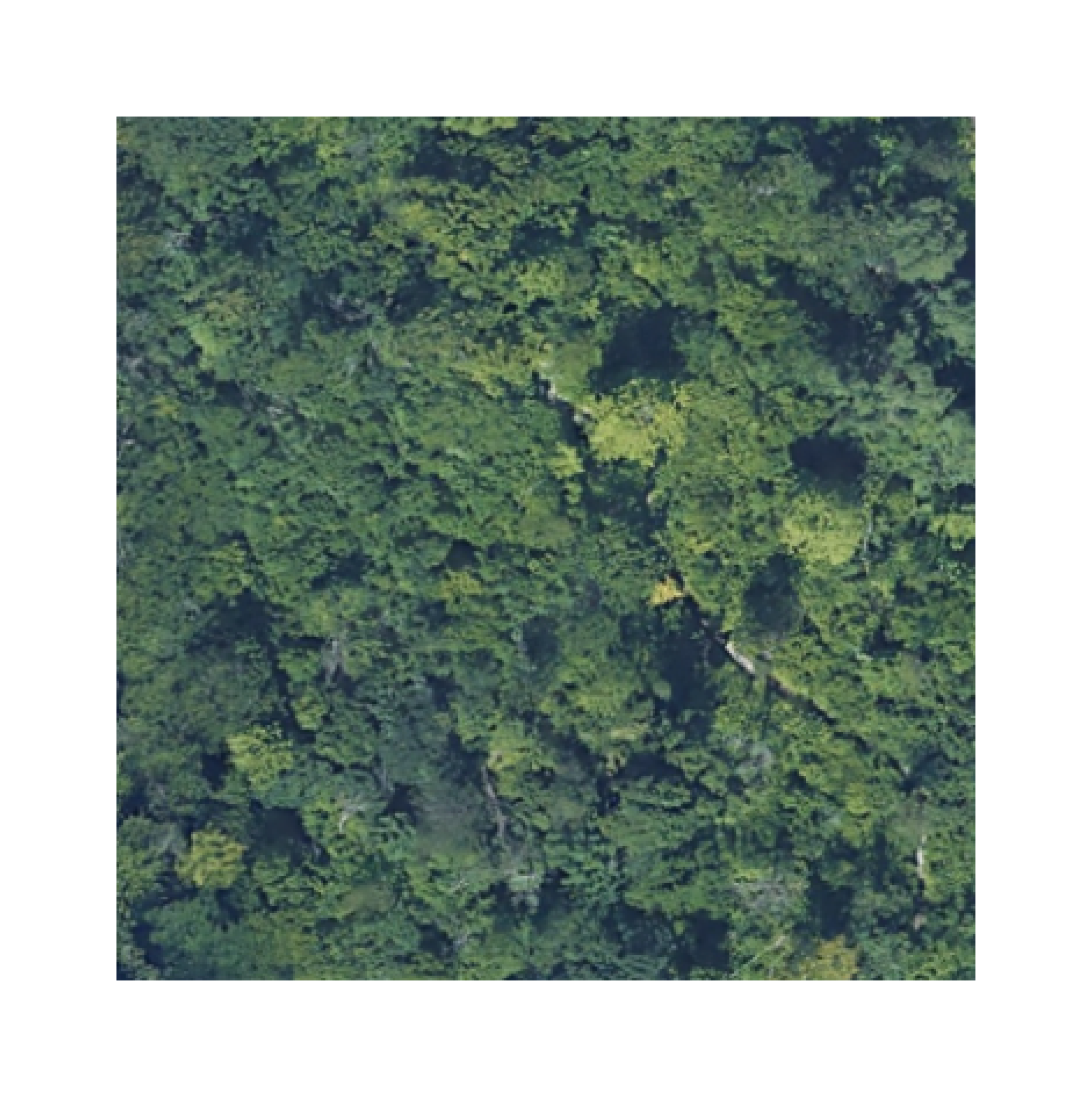
A stitched vegetation map created by TensorForest, showcasing our ability to create comprehensive forest visualizations from multiple drone captures.
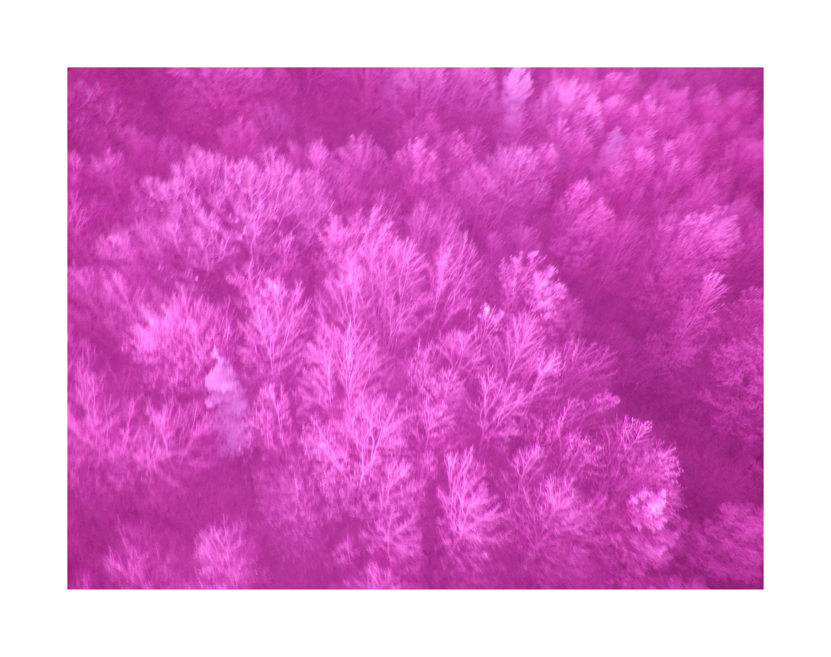
An NDVI capture used to generate heat maps, showing vegetation health and potential fire risk areas.

Our modified GoPro setup used to capture NDVI data, providing crucial vegetation health information for risk assessment.
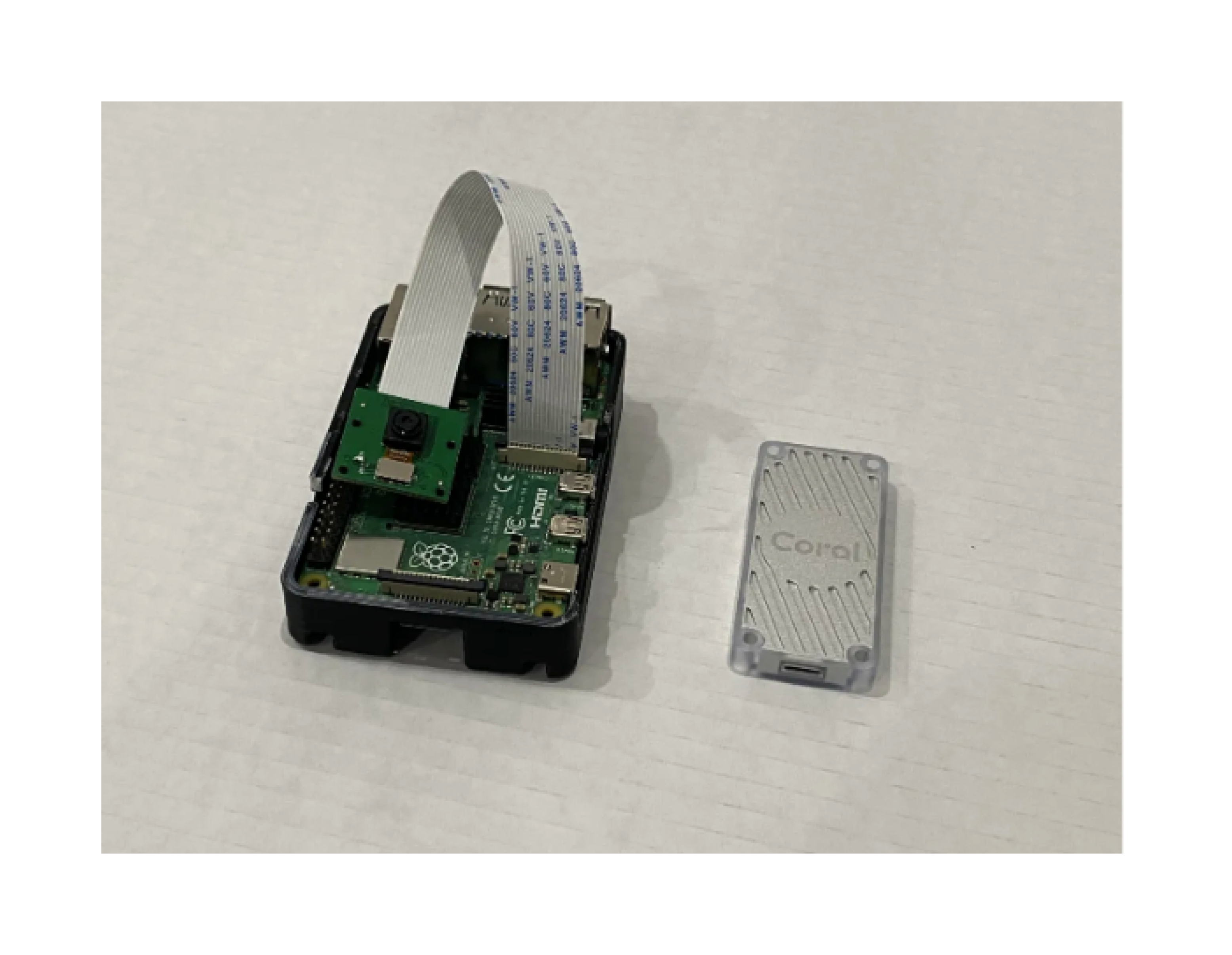
The Raspberry Pi computer module with Edge TPU that powers our onboard image processing and AI analysis capabilities.
Current Development & Funding Needs
We are actively seeking microgrants and funding to enhance TensorForest's capabilities:
-
Scaling hardware and software
- Acquiring higher-resolution LiDAR sensors for improved accuracy.
- Developing longer-range drones for large-scale forest monitoring.
-
Enhancing AI Model Accuracy
- Continuing to train and refine the wildfire risk assessment model, requiring more computing power and diverse datasets for improved accuracy.
Get Involved
We are continuously working on improving TensorForest. If you're interested in this project or want to collaborate, feel free to reach out at rohanth.marem@gmail.com.
